The Ghost of the Pit
Point of Ayr - A gas terminal now occupies the colliery site
After the last walk’s misadventures, I was faced with a dilemma for this next leg of the journey. The WCP offers an alternative route - at least it does according to Ordnance Survey. The coastal route hugs the sea wall for a short distance and then is forced to follow the A548 for a couple of kilometres before escaping to the coast once again. The alternative route leaves the coast and crosses the A548 and heads into the hills above Mostyn. It been a while since I faced much in the way of a hill, especially carrying a pack. Driving along the A548 on the way to the start I decided that I didn’t fancy any more roadside walking and I would take to the hills.

Tunnel under the railway at Llannerch-y-Mor
It was about 8:30am when I set-off and the promised heatwave from early in the week had somehow changed to cold air from the North. The wind had enough bite for me to grab an extra layer and don my Valleret gloves. First I had to retrace my steps back to where I was tide bound on the last walk. You can see the tunnel I needed to walk through on the right. That had been barely visible due to the very high tide. This time I know the high tide was not until 12:40 and was a few metres lower than it was that Easter weekend.
You follow the left tunnel to regain the path and follow it round till you reach the Duke of Lancaster again. You then have about a kilometre along the sea wall bringing you out opposite Mostyn Docks. I found a new section of path that my digital OS map did not have marked. It takes you through a pretty glade of Silver Birch trees before reaching a side road which accesses a bridge back over the railway.

New path through the birch trees.

To take the marked route of the WCP you have to back track a little back towards Flint and look for a path that leaves from the corner of a pub car park. The signage for the path amused me greatly as I can’t imagine that there are many bridleways that start with a set of steps. It looked a bit steep but I was committed now. It was time to delayer and man-up. Actually, it went better than I expected. Although the climbing seemed a bit relentless the gradient was manageable and consistent. Talking off signage, don’t expect to see any WCP logos on this route. The path comes out into a residential area with largely unmetalled roads that look like at any moment you are going to end up in someones drive. It seemed that the path was blocked at one point so I detoured to come back to the road towards Tre-Mostyn. The road follows the high stone walls of the Mostyn Hall Estate past a pretty church and under an impressive arched bridge.
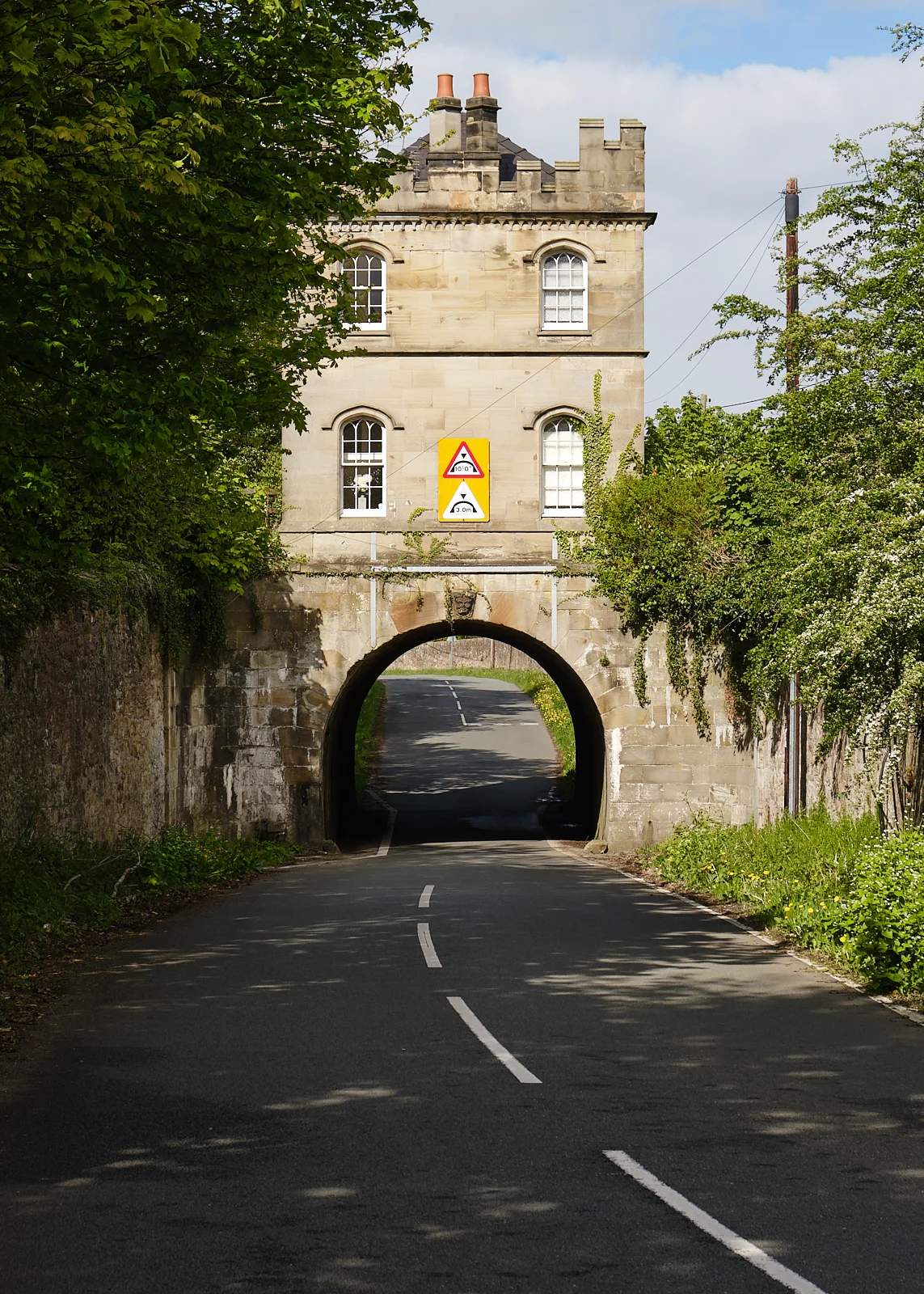
Ornate arched bridge on the Mostyn Estate
The ground here levels out an the hill gives way to wide open fields. I had a nice long chat with the occupier of the lodge house. He had spoken to other WCP walkers taking the detour in the past and this gave me confidence that I was on the right track. Shortly after the lodge you take a footpath off to the right which takes you through the fields and down into the valley of Nant Fellin-Blwm. This feels like a forgotten valley, densely wooded with a fast flowing stream at its heart. I met just one group of walkers which added to the sense of remoteness.
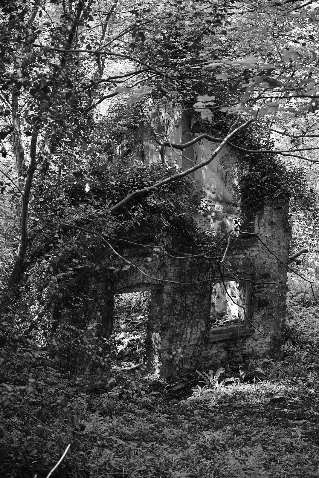
Derelict building reclaimed by the woods.
Here and there were splashes of colour where woodland flowers and rhododendrons were flowering in patches of light. I was just thinking how nice it would be to find a more open patch with a carpet of bluebells when the woods on the opposite side of the stream suddenly opened out and delivered my wish! At this point I felt that 100m of climbing had been well worth the effort.

Bluebell glade
The path follows the stream as it drops back down the hill towards the coast finally reaching the edge of Ffynnongroyw. At this point you are back at the road but the path follows the old course of the road through the village whilst the A548 now bypasses the town. The WCP crosses the A548 and heads towards the coast and you see the first monument to the once extensive Point of Ayr colliery.

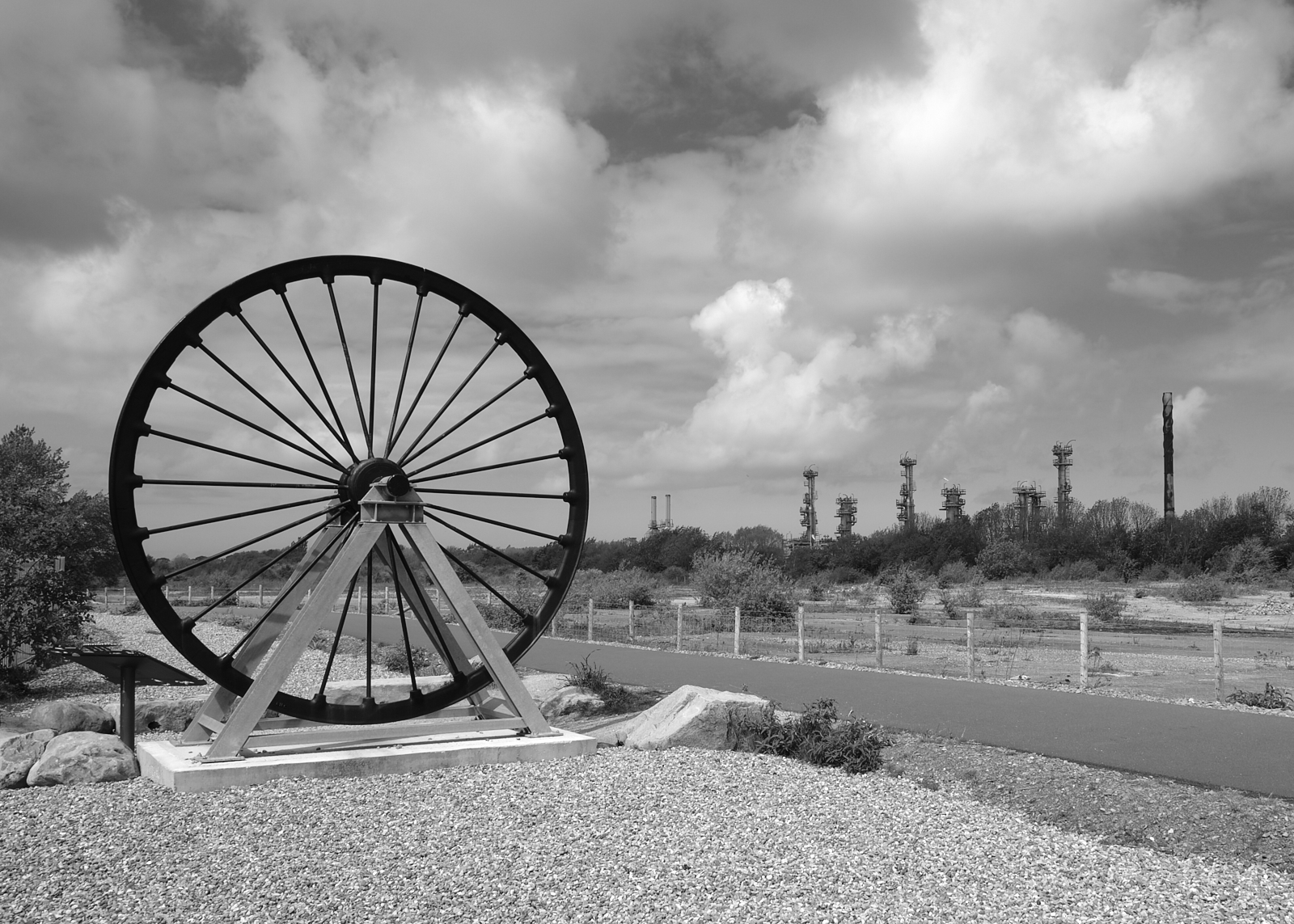
Number 2 Shaft - Point of Ayr Colliery
For over a hundred years the colliery mined coal from the Flintshire coal fields and out under the Irish Sea in Liverpool Bay. It was the last mine to close in North Wales in 1996. In the 20 years since then the whole site has been cleared and barely anything remains of the colliery on the surface. The location’s relationship with fossil fuel has not completely ended as it now hosts a gas terminal which takes natural gas from the rigs in Liverpool Bay and processes it for use in the Connah’s Quay Power Station I passed on an earlier walk. Despite all the drawbacks of the coal industry, it does seem sad to see that industry and its history so completely obliterated in such a short time.

The pit ponies of Point of Ayr still remembered against the backdrop of the Gas Terminal.
There is more to Point of Ayr than just heavy industry though. The headland itself marks the end of the Dee Estuary and the start of the North Wales sea coast. It is also the home to a RSPB nature reserve and the water was filled with as many seabirds as I have ever seen in one place floating in the calm waters on the rising tide.

I pushed on towards Talacre along the well-maintained paths past the marshlands. If I hadn’t become quite so focussed on finding a spot of lunch in Talacre, I might have taken the detour that takes you to a RSPB hide that gives you a closer look at the local bird life.
Up till now I had seen few people along the path but, as I neared Talacre, the numbers started to grow. It was a bank holiday weekend after all even if a chilly one. If the rising number of people was not enough proof, the iconic terracotta roof of the lighthouse appeared over the top of the dunes. Talacre is spread along the road that leads to the beach from the coast road but I didn’t venture very far. I stopped at Lola and Suggs Beach Cafe right next to the beach as it had tables outside and I was in big boots that still had some forest mud in evidence. They were still serving a full English breakfast so that was my choice making up for the planned one I failed to reach last time out. It was very tasty and good value.
With refuelling and recaffination complete I headed towards the dunes with some trepidation. It was now just before one and just after high tide. I wasn’t entirely sure how much beach there would be to walk on. Fortunately, there was still plenty of beach left and I new the tide would be retreating from this point.

Talacre Beach looking towards the Wirral and Liverpool Bay

Point of Ayr Lighthouse
The Point of Ayr Lighthouse dominates the beach. It has a few rough edges but you can forgive it that when you realise that it was completed the same year America declared its independence. It has been retired now for 135 years, but still it endures. How many tides has it seen come and go and how many storms has it weathered. At this most Northerly point you can see round the end of the Wirral to the Liverpool skyline beyond.
Despite the sun being out, it hadn’t really got much warmer. This was not going to dampen the enthusiasm of the hardy holiday makers who got on with the serious business of eating picnics, building sand castles and paddling in the pools left by the retreating sand. The easiest ground to walk on was the steeper bit of beach just below the high tide point. Its was firmish, if a bit crunchy, but lacked the softer sand and ankle-turning pebbles of the higher beach. The beach is wide, long and straight as the tide recedes. I started to notice a mirage effect as the reflections in the sand made distant walkers seem distorted giants.

Apparently you don’t need heat for a mirage

You’ve not seen me …right?
I could also see large populations of sea birds on the beach. It looked like you could walk right up to them but that also proved to be an illusion as I tried to get close enough to grab a photo. The pools between me and them still looked well over boot depth so I was forced away from the shore and behind some marshland. This stretch of coast is an important breeding ground for rare species like Natterjack Toads, Sand Lizards and Little Terns. I didn't see any of those, but I did spot the chap on the right. I don’t associate Pheasants with the sea - maybe he was on his holidays. In the UK, Pheasants are mostly bred to shoot at. They do like long grass as a habitat, preferably where people are not shooting at them.
The tall reeds in this part of the beach are in contrast to the short, spiky Marram Grass that covers the dunes. The grass performs a valuable service in stabilising the dunes and preventing erosion. Some of the dunes are impressively tall, towering over the beach.

As you reach Presthaven Sand on the edge of Prestatyn, the path coverages briefly with the cycle path before diverting you back towards the shore and the Gronant Dunes Nature Reserve. The path follows a line between the dune ridge and Prestatyn Golf Club. It’s a little hard going in places as the sand can be on the soft side which is energy sapping. In my teens, I was a junior member of the PGC. I wasn’t a member very long and I don’t think I was a great loss to the grand old game. My mind started to wander and I was passing the last resting place of any of my more spectacularly “out of bounds” shots.

It was also a more poignant moment for me. Just on the other side of the gold course are the old Kwik Save offices. All along my walk so far I have passed different bits of industrial history. Some of the more recent “casualties” I can still recall and had school friends whose parents worked there like Courtaulds at Greenfield or the Point of Ayr colliery. With Kwik Save it is more personal as we have a strong family connection with the company. At its height, it was one of the country’s leading supermarket chains. Prestatyn was an unlikely place to be head-quartered for such a major company but it grew mostly organically from this small seaside town to cover much of the country. This made it an important local employer particularly for young people. When I left Kwik Save in 1987 I was already a one of the old guard at the heady age of 23. Unfortunately, an unhappy series of takeovers and mergers lead to the company first losing its way and finally its existence. It would be easier to understand if, like some of the other fading industries, its demand had tried up. However, the place in the market Kwik Save once held was taken by the likes of Aldi and Netto who have been amongst the most successful retailers of recent years when austerity started to bite. What is left is the memories I have of happier times and the fine people who I used to work with.

Sculpture at the Nova Centre
The path brings you out at the end of the Prestatyn promenade and the end of this walk. My sister had walked back along the path to meet me and we walked along the prom to the Nova leisure centre. This is also the spot where the Offa’s Dyke path meets the Wales Coast Path. The Southern end of both paths is Chepstow in South Wales. This means that if you can do a complete lap of Wales if the urge takes you. Baby steps Andrew…baby steps.