Hot Around the Castle

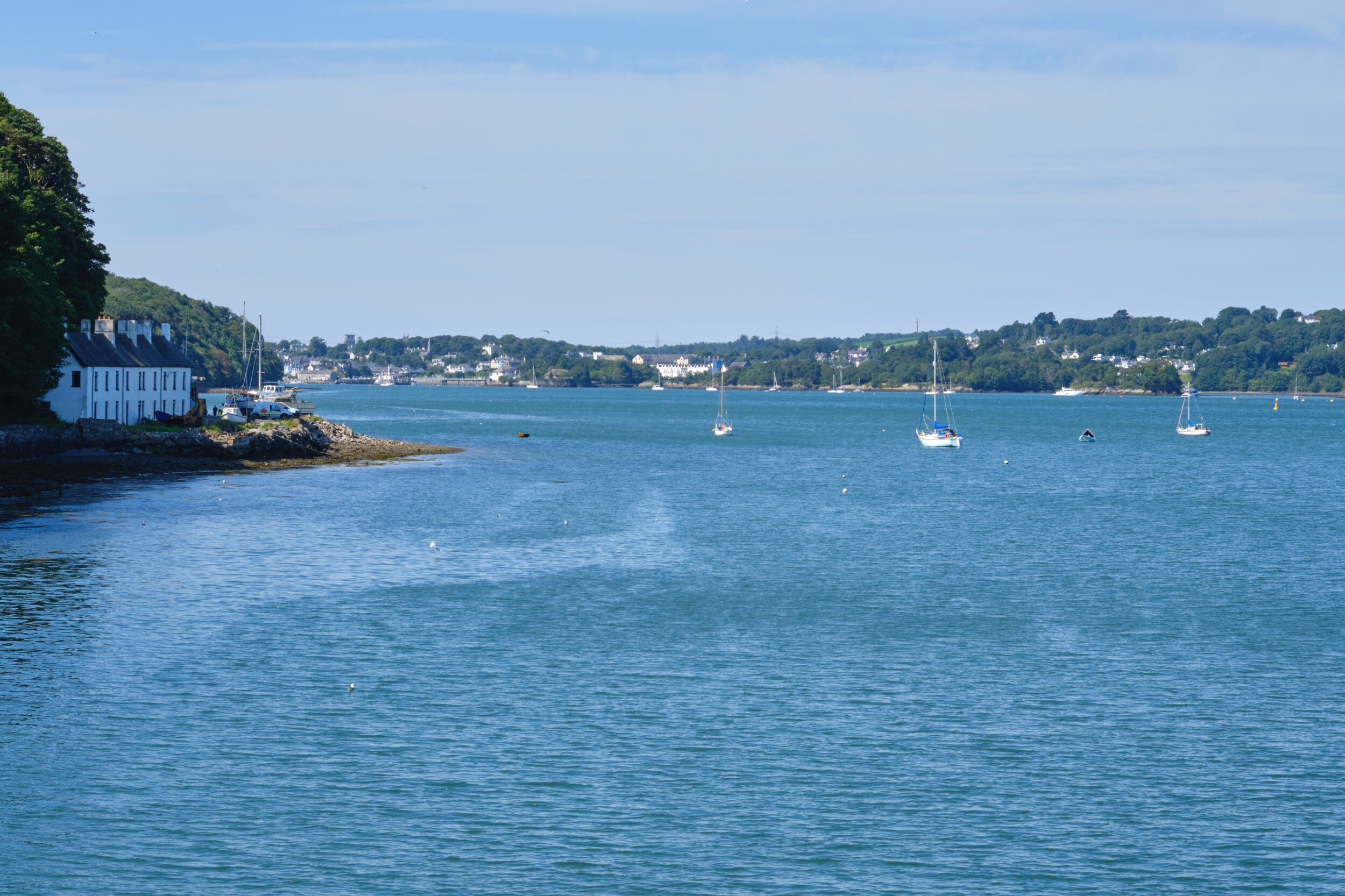
Western entrance to the Menai Straits from the Garth Pier, Bangor
This walk is another one I decided to do West to East. The map showed that most of the hills were going to be at the Bangor end and I wanted fresh legs for those. I took the train from Llanfairfechan to Bangor and arrived about 8:40am. Bangor Station is in the middle of the town but I wanted my start point to be the Telford Menai bridge. This was so I could make the choice of when I incorporated Anglesey into the walk. So the first job was to make my way over to the bridge. I soon learned that Bangor is never really flat. You have to climb over a ridge and drop down to the bridge.

The two bridges over the Menai Straits descending from Bangor.

Telford Suspension Bridge from the Bangor side
In the beach trips of my youth, only Telford’s Suspension Bridge carried road traffic. Although it was another pinch point on the route, it was always a highlight for me. I have kept my love of bridges and grand bits of civil engineering but Telford’s bridge over the Menai Straits is still a favourite. Now the A55 uses Stephenson’s Britannia Bridge and the traffic is lighter these days. One of my last visits here was to watch the Tour of Britain race over the bridge. It was a great sporting occasion but it was matched by the suspense of watching them try and get the Team coaches under the arches before the race.

From the bridge you have to backtrack towards Bangor along the A5 before leaving the road at a roundabout and heading past the university sports fields. The OS Map here is a little imprecise. It looks like you cut across a field but actually the path is at the end and accessed by a stile. It is then fenced off from the fields - guess who learned this the hard way. Once you get the correct path you come out at the Nantporth Nature Reserve. The path runs along the Straits inside dense woodland. The shade was welcome but the walking is a little hard going. The path is quite muddy and, though not really climbing, undulates up and down sets of wood reinforced steps. It must have been a labour of love cutting all those steps but it was a bit of a workout.
You emerge at the top of the wood and then drop down to a little beach with great views down the Straits towards Bangor Pier. I stopped for a snack and took in the views. I spotted a Little Egret in the rocks, I tried to get a little closer for a photograph but it took off and headed up the Straits

Egret deciding I had got close enough.

The Garth Pier, Bangor
The path climbs steeply up a side road and then drops back down to the sea through a park to the pier entrance. The Garth Pier is an attractive Victorian structure that was saved from demolition by a concerted local effort. Originally used as a landing stage for pleasure steamers that ran up the North West coast and over to the Isle of Man, it now offers great views along the Menai Straits and out into Conway bay.
Westward view from the Garth Pier
The WCP diverts round the town and over towards the harbour. I could have done with it diverting a little less, as I was still on the look out for extra water, but I was bound to pass a shop soon, right? The prominence of Bangor was raised by the building of the bridges creating a transport corridor to Ireland and by slate mining. The harbour was the exit point for slate being mined in Bethesda.

Port Penrhyn, Bangor

Gatehouse for the Penrhyn Estate
The WCP leaves the coast at this point (if you don’t miss the sign like me - being too keen to cross the bridge). It heads along the paths using the old tramway and waterways that brought to the slate down for export. It also skirts the edge of the Penrhyn Estate. Ironically, I was meant to visit Penrhyn Castle that day with family and I have never actually been there. Today, it was decidedly in the way, giving me a long detour.

Bridge over the Afon Cegin at Port Penrhyn

The WCP climbs constantly but at a nice steady gradient that is not to hard on the legs. What was much appreciated on what turned out to be the hottest day so far in 2020 was the shade from the woods and the cooling effect of the river. Every so often, you come across some relic of the industrial past now reclaimed by nature.


The WCP breaks cover from the woods just after you cross the railway. The path runs along a country road with no footpath. Despite the fact this road has to cross a ford, it seemed to be quite busy. All except for the time I waited at the ford for a car to come through it! Fortunately, its only a few hundred metres before the WCP leaves the road though the route is not exactly encouraging.
Despite the blockages and security signs I followed the arrow and this lead me down to a road which I struggled to see why existed. It was all shiny and new, A-road wide with a cycle and pedestrian path. It just didn’t seem to go anywhere. Every 100m or so there would be a turnoff that ended 10m later in a field. With no real cover it was baking hot and rose up to the highest point of the walk, near Llandygai. It ended as it joined the main road but was even less welcoming at that end. Were they just trying to spend that European money before Brexit?

The Road to Nowhere?
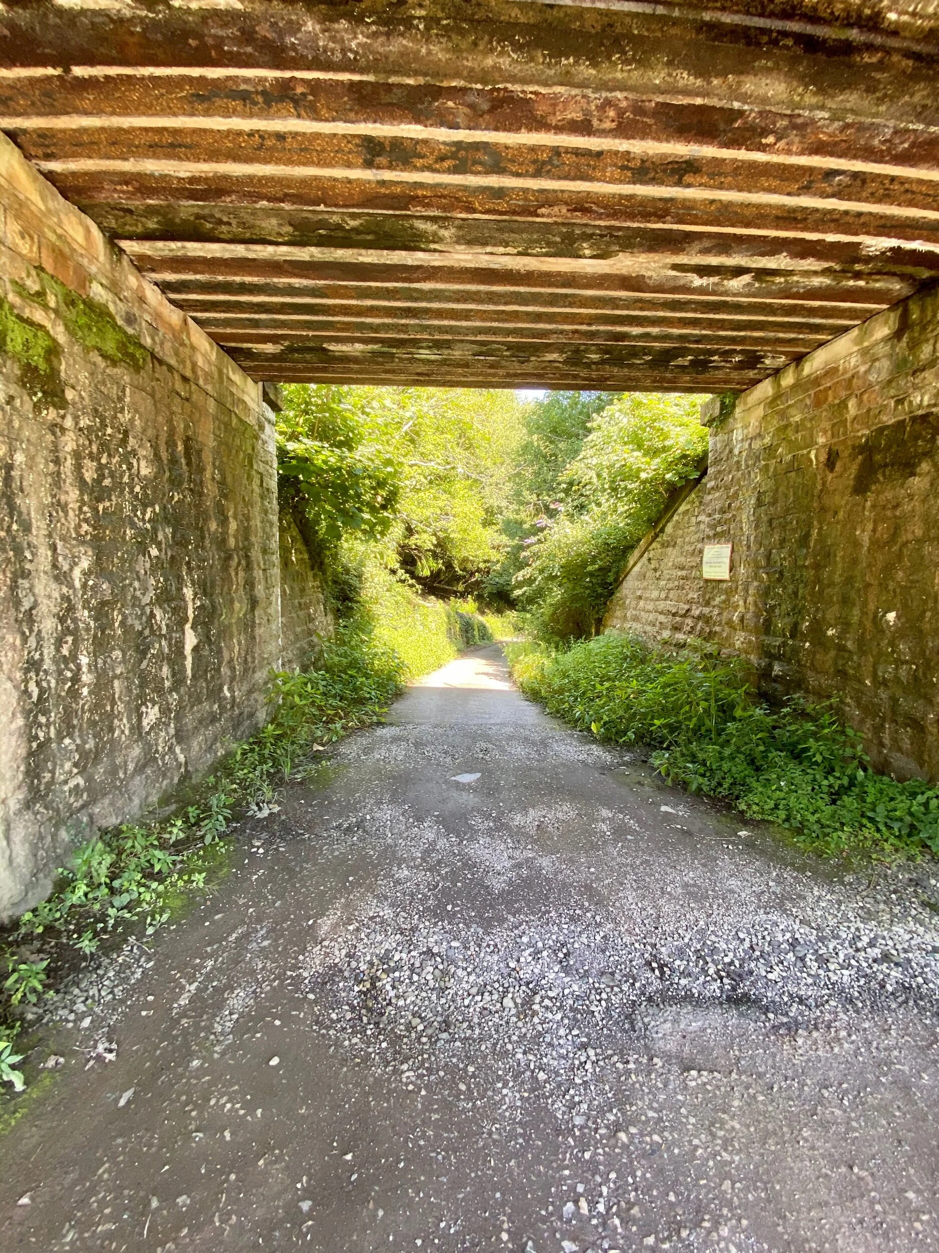
Railway underpass
The next part of the walk was really mostly a navigational exercise as the WCP tries to get you back to the coast avoiding the main roads. You have to be vigilant for signs and have faith in the map. There are parts where you are skirting private properties and the railway.

Local resident following mask advice
Eventually you come to a B-road that takes you back to the coast. Another one with no footpaths, but roadworks at the top meant very little traffic - just a few cars using the car park at the coast and the bin lorry. So the good news was that the path was now living up to its billing and all the significant climbs were behind me. The bad news was that I still had 10km on tired legs to go and I only had a swig of water left. I sat on the bank for a contemplative snack and that last swig. This proved less than restorative though as I managed to sit on an ants nest. No-one was happy about this - not me, not the ants. Oh well, maybe a shot of adrenaline is better than a rest?

Across the Bangor Flats towards Beaumaris. Surprising number of swans on the mudflats.
Back to the West, Penrhyn Castle rose from the landscape. This property, now part of the National Trust, is not one of the chain of Edward’s castles like Beaumaris across the straits. Though it does go back to medieval time and Welsh aristocracy, the current form is more due to the wealth generated by what was once the world largest slate quarry. That wealth was also, more controversially, originated from Jamaican plantations.

Penrhyn Castle

Just wrapping my hay
The looming form of Penmaenmawr seemed a long way off. The WCP picks its way between the mud and sand of Traeth Lafan that stretches so far out at low tide you swear you could walk to Penmon on Anglesey and lush farm land. Farmers were out quite literally making hay while the sun shines. I was captivated for a little while watching a tractor wrapping giant hay bales in black plastic.
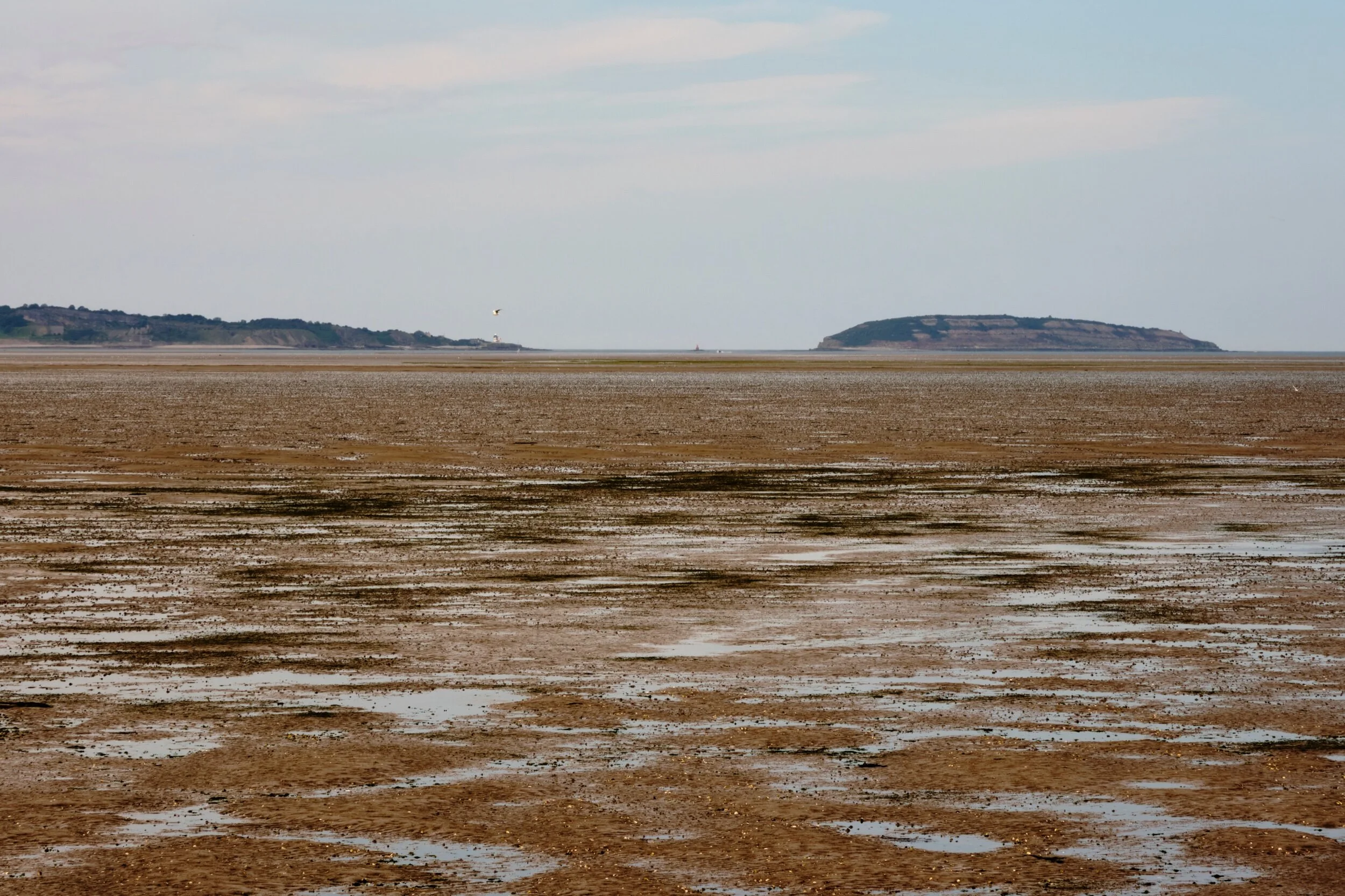
Traeth Lafan

Occasionally the WCP departs from beach and lead along the edge of the fields. Golden crops swayed in gentle waves in the sea breeze. The weather had got slightly more overcast, with the sun mercifully only popping out occasionally to light up the landscape. I was starting to feel a bit dehydrated and sorely regretting not making more of an effort in Bangor to replenish my water. Fortunately, I spotted a walker lugging a full 2l bottle of water heading back to a nearby car park. I manage to scrounge a refill from this unnamed Good Samaritan - God bless you, sir.
Much of the remaining walk followed this same pattern. As I got more tired the camera started to come out of the bag less. I was more focussed on just keeping my feet moving and counting down the Kms.

Remanants of sea defences that lost their battle

Just before you arrive back in Llanfairfechan, you cross into an area of different habitat. A sign warned for walkers and canine companions to keep to the paths to avoid the nesting Ringed Plovers. I couldn’t see any but then that is kind of the point fro the plover perspective. A little bridge crosses the mouth of Afon Aber Rhaeadr Fawr which carries water which has flowed over the notable Aber Falls a few miles inland. I detoured a little to cross the extensive grass lands on the lookout for wildlife as it didn’t extend my route. After this, the path starts to become part of the Llanfairfechan promenade and the number of people about increases dramatically.

After prising my boots off, I climbed gratefully into my pre-cooled car (thank you Jaguar app) and broke into my emergency water supply. Overall, with the pre-walk to the bridge it worked out a smidge under 30Km with 300m of climbing. On the way home, I treated myself to a giant Venti Iced Skinny Latte which I had started to fantasise about from about 8Km to go - cold caffeine heaven!