Merlin and the Bog Monster
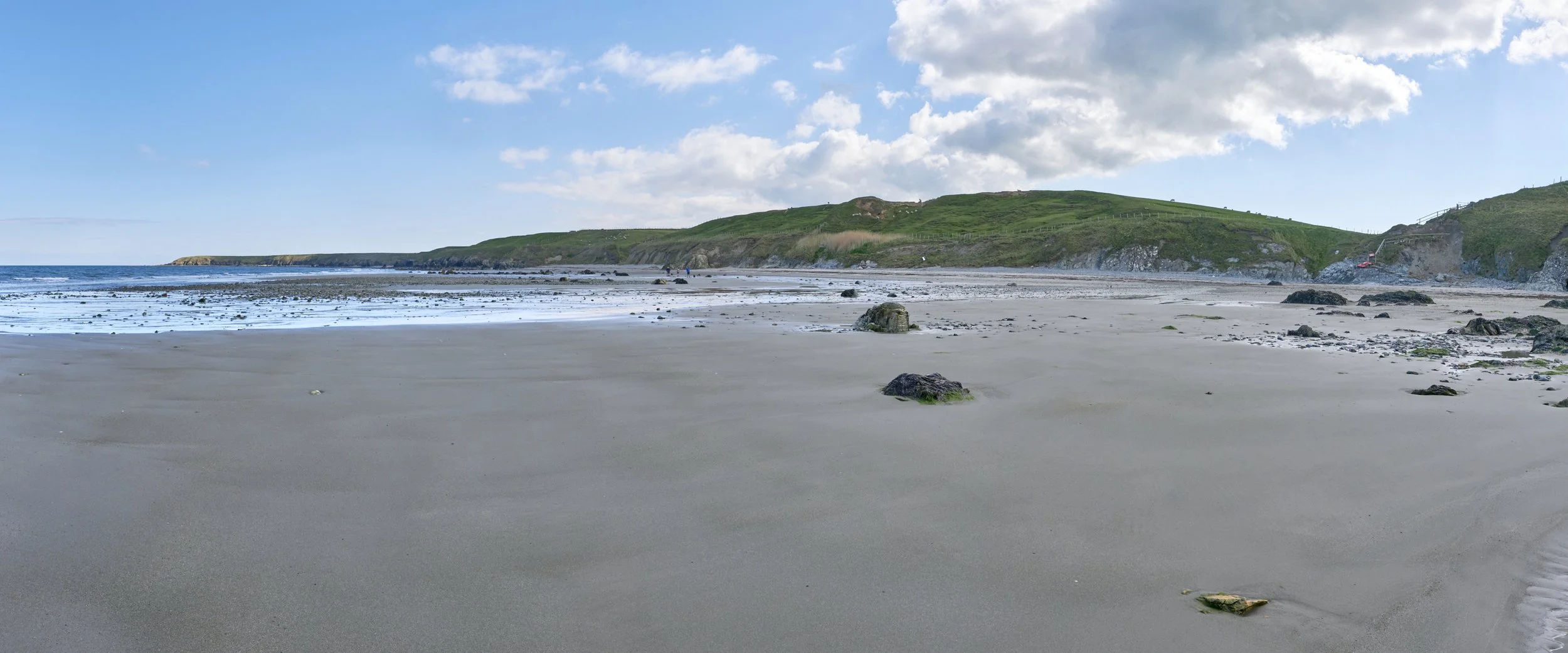
The wide expanse of Traeth Penllech at low tide
Life has not been easy to plan in early 2022. I had been eager to get my Wales Coast Path (WCP) odyssey back on track but had failed to get out there. In the end, I decided that I just couldn’t sit at home through another nice weather period waiting for all the variables to come together for a multi-day trip. Monday 25th March had no appointments, a decent weather forecast and the Easter Holiday crowds should have dispersed. It was time to hit the road.
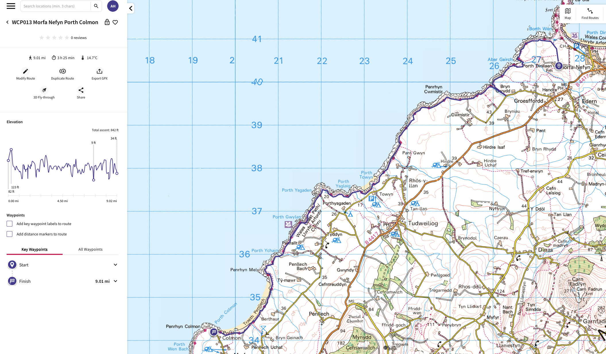
Route Map and Profile
The perennial issue of how to return from the walk needed to be solved. Morfa Nefyn is a decent size by Llyn standards but Porth Colmon is just a hamlet and well off the beaten track. I looked for a bus route and I got a link to Fflecsi. This is an on-demand bus service. It only operates on certain days and in limited areas, but I qualified on both counts. I booked a trip from the National Trust Car Park at Porth Dinllaen (from my last walk) to Porth Colmon for 9:45 am in the morning. No turning back now.
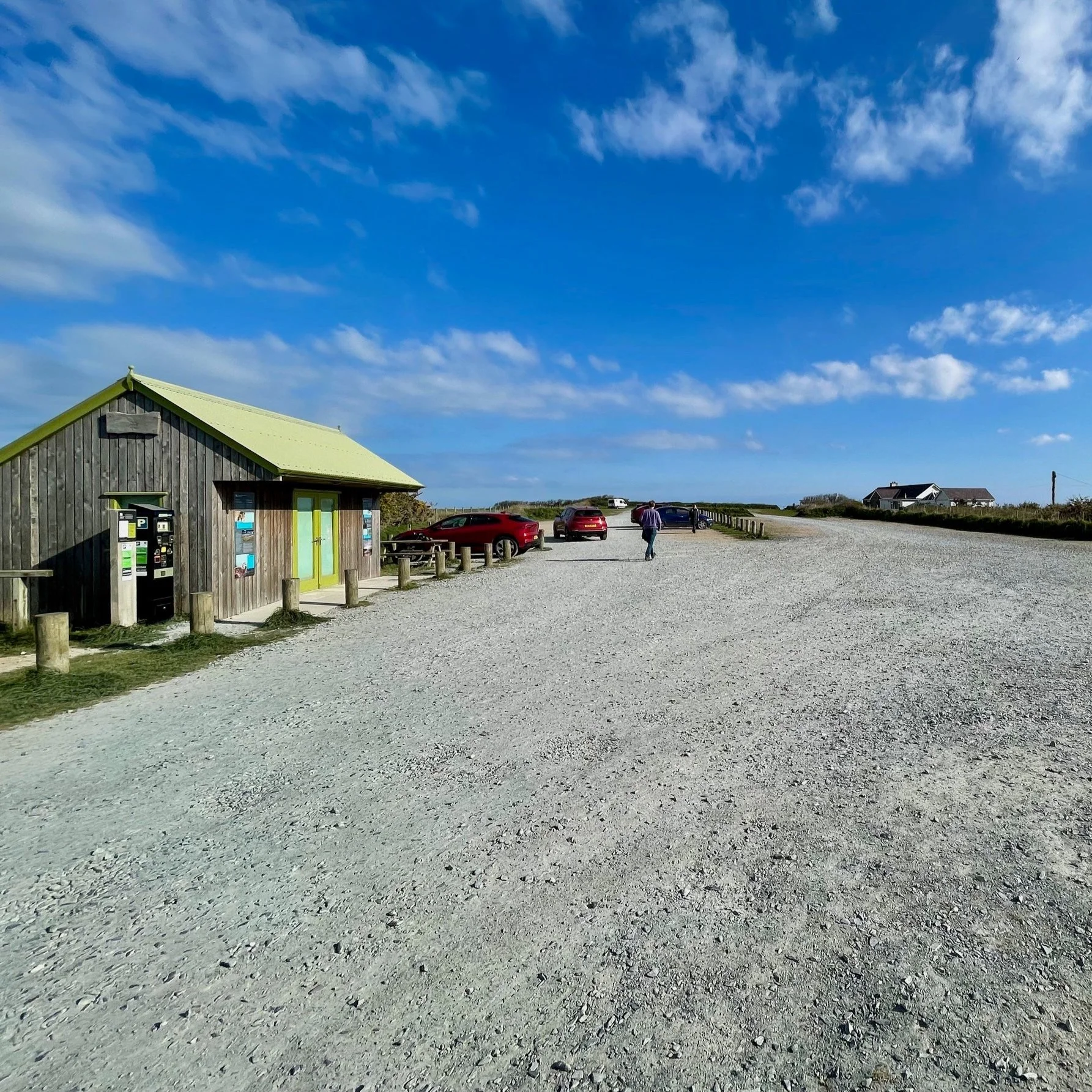
Empty National Trust Car Park
The I-PACE won out over the camper for the journey as it was a day trip. The sun was out, but it was only about 5°C. Traffic was still light as I headed off at about 7:15 am. It took a couple of hours to do the 90 minute trip and I pulled into a virtually empty car park. I had used 43% of my battery on the journey. It seems remarkable to me now how far I have walked and yet there is still so much more to go. There is a single free vend slow charger and I plugged in and waited for my bus.
The Fflecsi bus arrived a bit early, but the tight country roads and indirect route meant it was 10:00 am by the time I started. Only £3 makes it a bit of a bargain. I was about a few hundred metres from the WCP. Did I go down to the port or follow the sign saying Cafe and shop? I decided to be diligent and do the former. When I got down to Porth Colmon, the sign had been covered for my direction and a barrier was lying next to the style in a highly ambiguous manner. I decided on caution given it was a solo clifftop section.
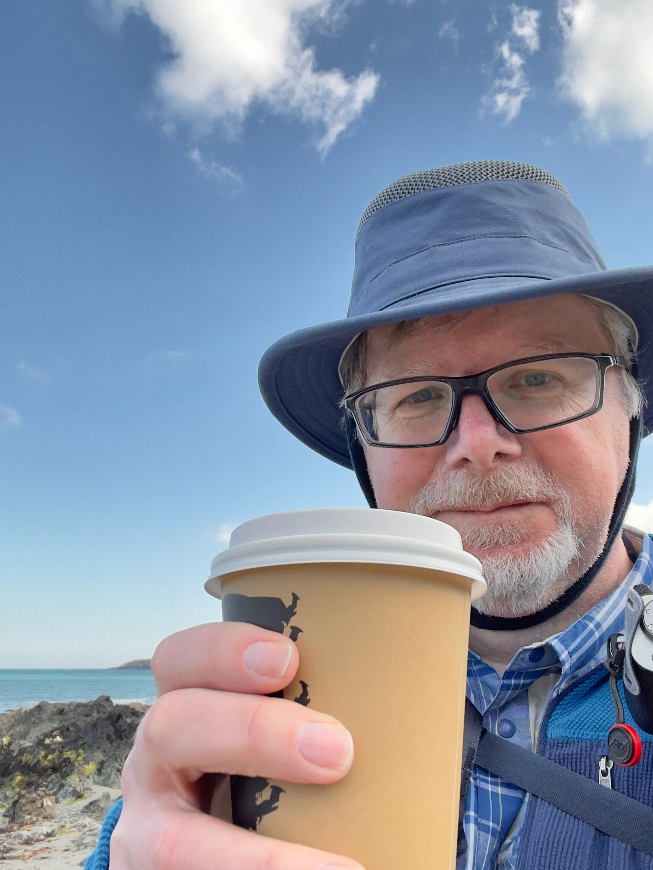
Happy Place ☀️🌊🏖☕️
I had to backtrack and go past the cafe at Moel-y-Berth campsite. At the cafe they told me there had been a cliff collapse and part of the path was closed. You could go round on the beach but only when the tide allowed. Given my past history with tides, I feared the worst, but my luck was in and it was low tide. And so it was that I found myself on the fantastic beach of Traeth Penllech with the sun on my face and a latte in my hand - I was in my happy place.
There was a chill to the breeze coming off the sea but that was likely to make walking more comfortable and at least it wasn’t a headwind. The route profile had a maximum of 123 feet and I thought it would be a good one to ease myself back into long walks. It was by no means flat though, as the sawtooth on the profile. The ground was hard and a bit of a washboard. I’ll take that over wet and slippy for a cliff walk - I just hoped my ankles would hold up.

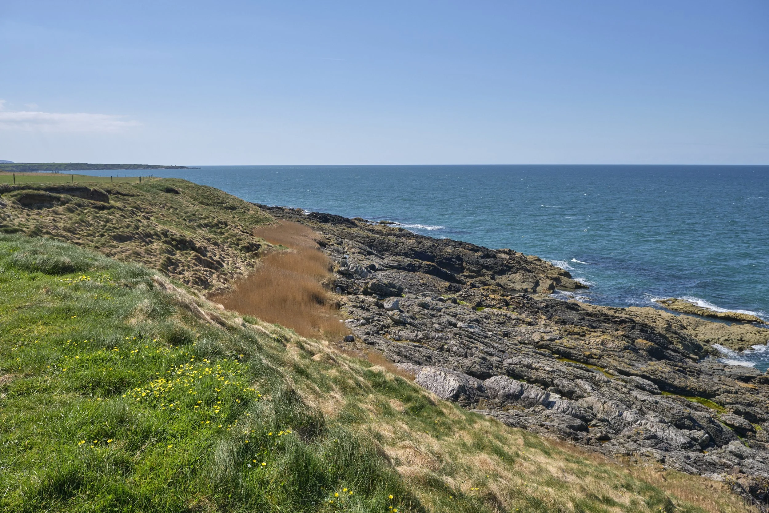
Typical piece of Wales Coast Path for this section
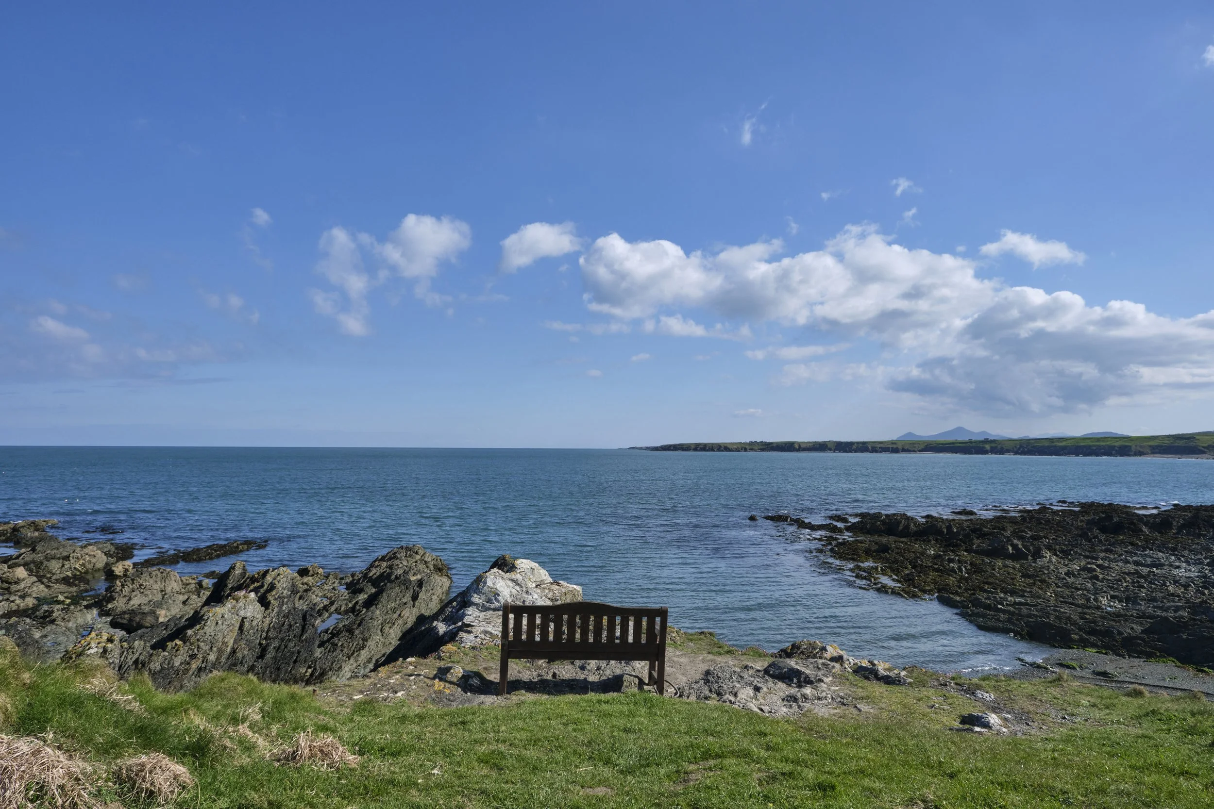
At the end of the wide expanse of Penllech, I climbed up to the WCP proper. This part of the Llyn Peninsula is less epic than the hills of the east, but no less picturesque. It is a winding collection of cliffs, inlets and little beaches so crinkly they could have been designed by Slartibartfast. Inland are large fields of open farmland sloping down to the sea. It is big sky country by Welsh standards. The path is penned to the cliffs by these fields. The land you cross on the WCP is wilder, more like a strip of moorland that ends abruptly at the cliffs.
The cliffs seem to be sandy soil sitting on rocks tilted up at 45° from some ancient geological trauma. Wales has a rich geological history that made it important in the development of geology as a science. I like a bit of geology, but I am glad I read this in Wikipedia after the cliff-top walk.
The western part of the peninsula (northwest of a line drawn from Nefyn to Aberdaron) is formed from Precambrian rocks, the majority of which are considered to form a part of the Monian Complex and thus to be closely related to the rocks of Anglesey. Numerous faults cut the area and a major shear zone – the Llyn Shear Zone – runs northeast to southwest through the Monian rocks. In 1984 there was an earthquake beneath the peninsula, which measured 5.4 on the Richter Scale

A bridge crossing a stream in one of the many inlets along the route
Water finds its way down from the central Llyn and in some place it forms little rivers that carve out a gash in the land like at Porth-y-Chain. The larger streams sometimes form little cascades as they work down to the sea. The WCP has to navigate around these inlets or you will find a little bridge. The sea also takes it toll on the coast and carves little bays and beaches. Navigating these might mean skirting round or taking on precipitous steps up and down the sides.
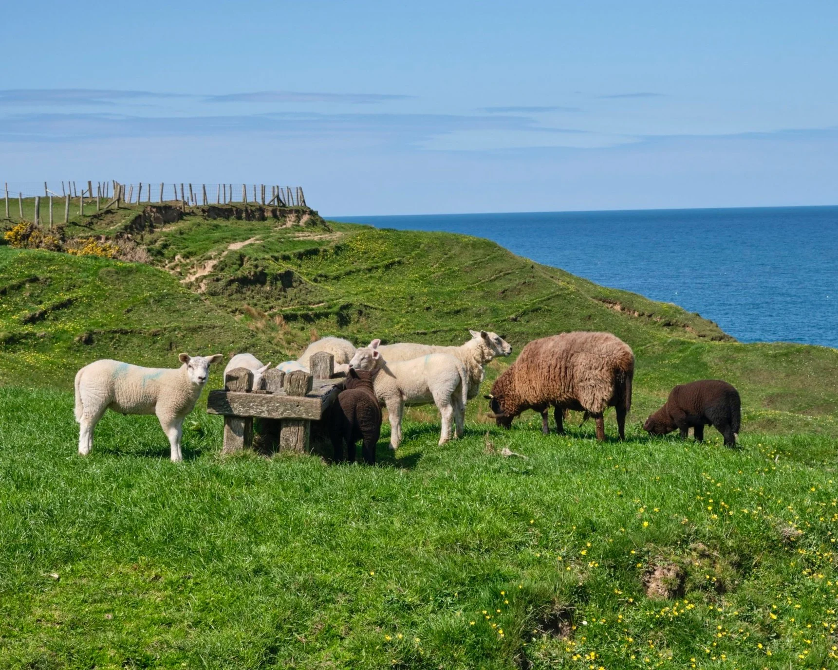
Not all the livestock is in the fields
The farming is mostly livestock, a mixture of sheep and cattle. Occasionally, the path will divert through the fields and you hope the occupants will not be too bothered by your incursion. At other times, the sheep share the path with you. Following the path can get a bit difficult as some of the worn trail was worn by boots and some by hooves. Follow the wrong one and it soon becomes clear which species is more adapted to this precarious environment.
Near Penrhyn Cwmistir you see signs saying “Seal Watching Point” and asking you not to attempt to approach them. I heard their distinctive “bark”. I managed to spot one in the water with my binoculars, but I failed to notice about half a dozen companions basking on the rocks for several minutes - so good is their camouflage. It was time to bring out the big lens.
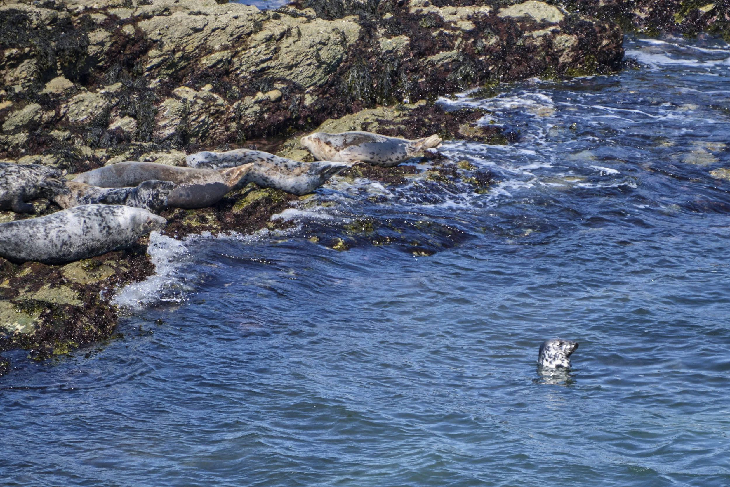
Group of Seals

A male Merlin ©RSPB
With a few frames in the can, it was time to move on. I had only gone a few steps when I spotted a bird in my peripheral vision to my right. It was less than 10 feet away, just above head high. I expected it to be one of the ubiquitous seagulls found all around the coast but it wasn’t. I could see from its wing-shape and beak it was a raptor of some kind. It was smaller and sleeker than the buzzards that had been hovering in the wind above me (probably hoping I’d fall).
As it arced around me it seemed to have orange, almost pink chest feathers and a grey head. Was it a kestrel? I’ve seen many over the years, but not this close or at this angle. It all happened too fast for me to grab a photo. After a bit of research and some advice later, I have decided what I saw was a male merlin. This was a first for me.
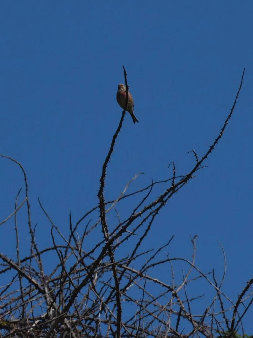
Linnet ready for a song
He would have been hunting for the small birds that frequent the gorse and shrubs along the wild areas of the WCP. Swallows and house martins zoom along the cliff edge and over the farmland. I saw wheatears and wagtails skipping ahead of me and heard the sweet song of a linnet (another new species to me). The most numerous birds would probably have been too large for a merlin’s lunch. Many, many seagulls of various types. I saw one chasing an Oystercatcher for a few hundred metres flying low over the rocks. Also numerous were the corvids. These were either jackdaws or something much bigger. So much bigger, I wondered if they might be Ravens.
One species notable by its absence were other humans. From a single family walking on Penllech up to a mile from Porth Dinllaen I didn’t pass a soul. I saw a farmer on a quad bike in the distance but no one on the path. I thought, as I was only just passed the Easter Holidays, it might be a bit busier. There were a few signs of past human habitation. Some ruined cottages and small huts along the headlands in the bays. The farmhouses were more inland, safe from the ravages of the sea and the worst of the winds. At some points, you skirt groups of caravans, but the sites seemed quiet.

Huts clinging to the hillsides
The now familiar peaks of Yr Eifl seemed to be finally getting closer. The Porth Dinllaen peninsula was recognisable by the Coastwatch Tower catching the sunlight.
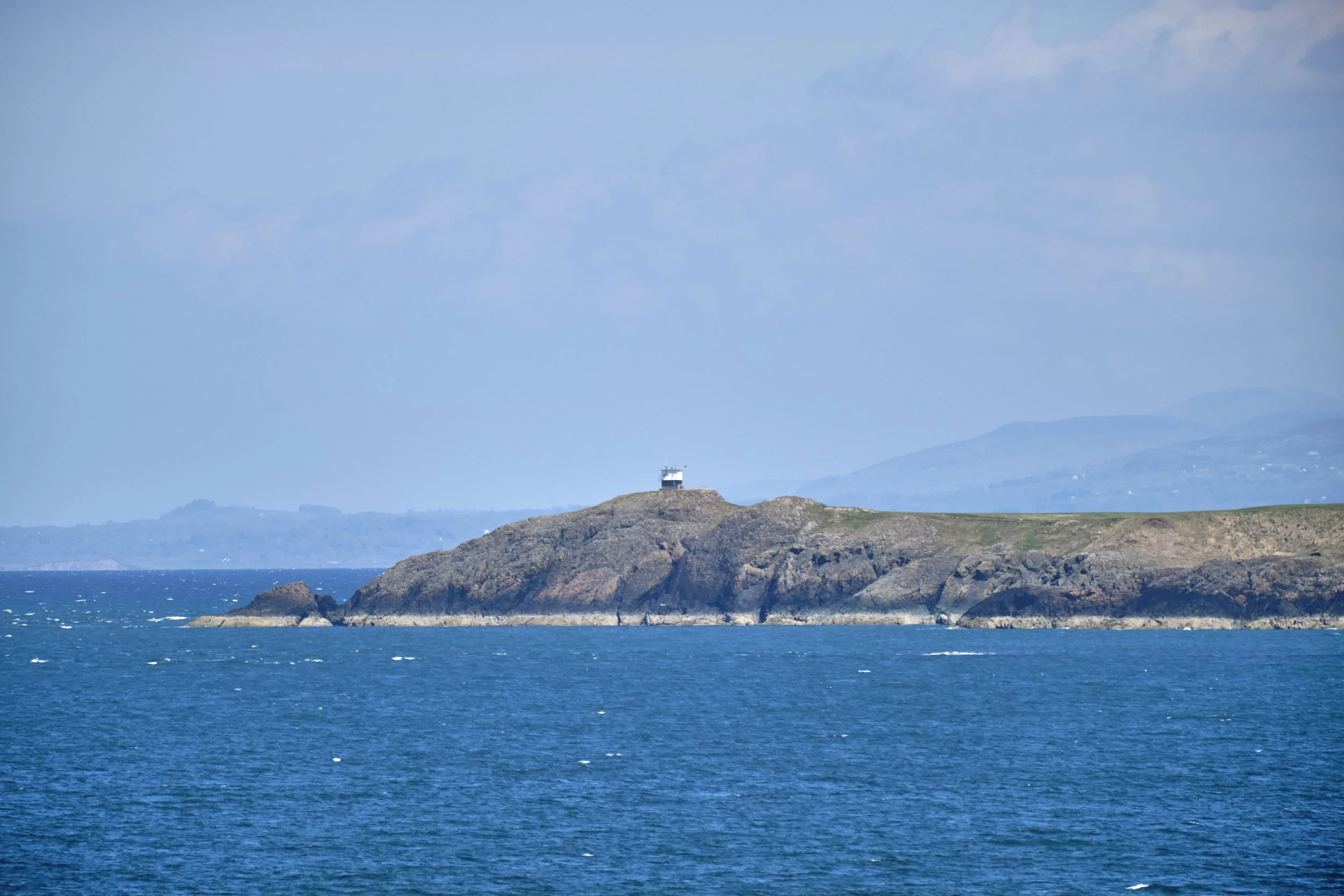
Porth Dinllaen Coastwatch Tower
With the first greens of the Nefyn and District Golf Club at Porth Dinllaen in sight, my thoughts turned to getting some lunch. It was 3pm so it would be late one, my pace having been slowed by detours and an abundance of caution. One last little bay to cross at Aber Geirch. The path as I descended seemed to have joined forces with the stream. There was a fork in it and I went the dryer way. This led to a low ledge that was more of a scramble than a path. Not too challenging even for a height-averse, tired and clumsy walker like me. I got distracted by a couple of Shelducks enjoying the stream.
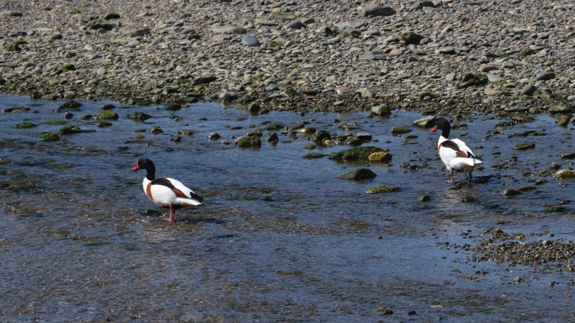
Shelducks
I spotted a couple of bridges through the marshy-looking bit. I decided that was the “proper” way - a big mistake. It looked like the area between the bridges might be marshy and there was a collection of long-leafed plants I didn’t recognise. I still don’t know what variety they are, but I would say they like their marshes deep. I ended up knee-deep in foul-smelling, clinging bog mud - the Bog Monster of the Llyn.
I had backups for many items of apparel, but trousers weren’t one of them. I wish I had a picture of my misfortune for you, but I was too consumed by disappointment to think of it. My chances of lunch had just evaporated into a cloud of bog fumes and my trip home had just got a lot more complicated. In the end, I decided clean and wet was better than muddy and wet. I joined the shelducks in the stream and found a stretch of stream that was deep enough to clean the worst off.
The last couple of kilometres were accompanied by a rhythmic squelching. This is, of course, when people started to reappear. I tried to act like nothing was wrong and retain a level of social distancing COVID has never required. Guess what is going in my emergency bag for my next trip!